Guide to implement Mobile Mapping in your Smart City
How cities are using Mobile Mapping for improving their digital services, and what to know if you want to replicate it in yours.
19 October 2020, by Mario Sabatino RiontinoAsk a question

Why Smart Cities need data
For the first time in history, more people are living in cities than in rural areas, a trend that is accelerating particularly thanks to China and India. In fact, the UN predicts that 68% of the world’s population will live in an urban area by 2050. Major changes will have to occur in the management and delivery of public services to accommodate this unprecedented growth. Cities will have to take advantage of digital technologies such as cloud computing, AI, 5G, robots and drones, just to name a few.
Enhance Smart Cities with data: Street-level and aerial imagery
One of the key components upon which virtually all of the Smart City services will be based is dynamic and up-to-date street-level data, allowing cities to monitor and improve:
- Road and urban planning
- Traffic and disaster management
- Decrease in pollution
- Community participation
The task of an administration is to create a legal and organizational framework for these interests and needs. In doing so, the usability of public space must be maintained, freely accessible areas secured, and the safety and fluidity of traffic guaranteed.

Municipal governments are not the only user of this information. Also, these kinds of services allow the private sector to create business value, including construction, ride-sharing, life safety, insurance, advertising, security, and package delivery logistics.
To collect this large amount of data, several cities are implementing mobile mapping solutions: Munich, Hong Kong and Vienna.
What is Mobile Mapping
Mobile Mapping is the process of collecting geospatial data (e.g. street-level imagery) from vehicle-mounted cameras. These vehicles are equipped with a range of sensors:
- Positioning (GNSS, GPS)
- Camera
- LiDAR
- Radar
- More remote sensing systems
Speed, efficiency and flexibility in collecting large amounts of data have made this technique the way-to-go for such projects.
Good case practice: Vienna
„Wien gibt Raum“ is a project financed by the City of Vienna to reorganise public space, as well as management structures and activities in the public space. The program, which will run from 2017 to 2022, is a framework for several projects of organizational or technical nature, making this comprehensive approach unique in Europe so far.
The entire city of Vienna was mapped by mobile mapping vehicles. Cornerning the mobile mapping campaign, the following outputs were defined:
- 77 days of data collection
- 4200km road network (total road network of Vienna)
- 21 million images
- ~100 TB data
- <10 cm spatial accuracy
- 3m distance between images
The data obtained was geo-referenced, anonymised and made available to the departments of the Vienna City administration in a web-based image data viewer for future local inspections or statements.
Data protection requirements for Cities
Like any other organization, cities and municipalities are subject to data privacy compliance (GDPR, PIPEDA, APPI, etc.). As we extensively discussed in this [blog post], consent from the citizens is required to collect, process, store and share data containing his/her personal information (e.g. face or license plate). However, consent is not required if data is anonymized (Recital 26 - GDPR).
A growing amount of cities is working with anonymized data as a way-to-go. For example, in the tender from the city of Vienna, specific requirements for anonymization needed to be matched for winning the tender:
- Blurring faces and license plates
- Automated Anonymization using Deep Learning
- 99% detection rate
- No systematic errors
- A low number of false detections (false positives)
Want to know more about this topic? Check our complete checklist for image blurring.
Furthermore, it is crucial to define accurately the relationship between the data controller (e.g. municipality) and each data processor involved (e.g. mapping company, anonymization supplier, etc.). According to the GDPR and internal rules, the data controller needs to require the following and many more agreements and documents from each data processor:
- Data Processing Agreement: also known as DPA, is a contract where the data controller says what the data processor (any third-party that processes the data) is allowed or not to do with the data.
- Technical & Organizational Measures (TOM): A list of measures where the data processor ensures data protection and safety in their processes and facilities.
- Data Processing Register: A register where the data processor documents how data is processed.
Read the summary of our webinar with a GDPR consultant to deepen into these legal requirements.
Prevent Citizens Concerns with Communication
As we observed in a previous article, the refuse from citizens for being filmed is the result of the so-called cognitive dissonance, i.e. a dissonance between what I expect (I want to give my consent before someone takes a picture of me) and what I see (someone is filming me, and I didn’t give my consent).
Result? Someone having a negative reaction. Also, even if firms and officials are moved by good intentions, their reputation might get hurt. The best way to mitigate the dissonance is by using communication, reframing and explanation. At the same time, anonymization has an enormous value because it eliminates any potential conflicts between the parties and allows everyone to fulfill their goals without any restrictions whatsoever.
Again, the project “Wien gibt Raum” of the City of Vienna is a virtuous example of what you can do to mitigate any potential conflicts:
- Mapping vehicles were marked with the logo of the city of Vienna.
- Multiple radio, TV reports, as well as online and print media were released before the beginning of the project.
- Informative brochures were carried by the mappers, which could be handed out to interested citizens.
- A detailed website in German and English was created to provide transparent information about the purpose of the project.
- All persons and license plates on collected images were blurred.
- The City of Vienna only receives anonymous data and is the owner of the image material.
Smart Cities of the Future
Virtually every city, large and small, has begun laying the groundwork for the types of services and kinds of environments that will be required to satisfy the needs of rapidly growing urban populations around the world.
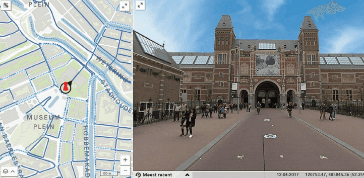
However, Vienna is not the only city that is focusing on mapping services for its citizens. Amsterdam boosts efficiency and access to spatial data through 360-degree geo-referenced images and aerial imagery to deliver more precise and detailed overview of the city’s land, buildings, and infrastructure.
Singapore is one of the most advanced cities/states in terms of implementing smart city initiatives. Estimates show that they spent nearly US$1 billion in 2019, increasing this budget up to 20% by the end of 2020.
In Summary
- Urban centres are facing an unprecedented growth. New technologies are playing a crucial role to improve the management and delivery of public services.
- Street-level data collected with mobile mapping and drones are among the most important pieces of information to optimize urban planning, traffic management and decreased levels of pollution.
- Vienna is a virtuous example in Europe. Through its Mobile Mapping campaign, they created a web-based image data viewer for the Vienna City administration.
- As required by the GDPR, street-level imagery was anonymized using AI-based image blurring.
- Every large and small city should take advantage of street-level imagery to optimize its service to the citizens. Vienna (Europe) and Singapore (Asia) are among the precursors of these technologies.
About Celantur
Technology
Celantur offers fully-automated image and video anonymization solutions to help companies and organizations comply with privacy laws. Our technology detects several objects to be anonymized such as faces, bodies, license plates, vehicles and facades, and automatically blurs them:
✓ We anonymize all kinds of RGB-imagery: planar, panorama and video
✓ Our cloud platform is capable of anonymizing around 200.000 panoramas per day and 90.000 video frames per hour.
✓ Industry-grade anonymization quality: detection rate up to 99%
Data Protection Standards
Data protection is our core business. That's why, to operate as a data processor, we have robust measures in place to comply with the GDPR and other data protection laws:
- Images are processed in GDPR-certified data centres in the European Union
- External Data Protection Officer at service
- All data and storage devices are encrypted
- Annual Data Protection Audit
- Up-to-date Documentation: Technical and Organizational Measures ("TOMs"), Records of Processing Activities and Data Processing Agreement
Communication
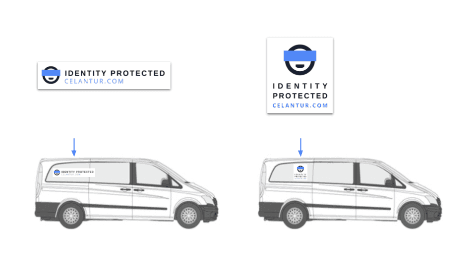
Under request, we offer our magnetic shield, allowing you to mitigate possible concerns about data collection and processing by communicating that identities are protected and anonymized through our service.

Ask us Anything. We'll get back to you shortly