Using Mobile Mapping for Digital Twins
Benefits, privacy and security implications when collecting indoor imagery data for BIM models and digital twins.
10 January 2021, by Mario Sabatino RiontinoAsk a question

Digital Twins and BIM Models at Glance
A digital twin is a computerized representation of a physical product, process or service, ranging from single machinery to a building or even a whole city. Thanks to an online connection between the digital version and the real one, it’s possible to run analyses to prevent potential problems from happening, improve processes, and many other applications.
The usage and applications of such technology is rising exponentially. In fact, digital twins was listed by Gartner as one of the top 10 strategic technology trends for 2019.
Large companies like Siemens, Multivista and Airbus as well as SMEs and engineering studios are adopting these solutions for improving:
- Digital Manufacturing
- Construction and engineering
- Asset management
- Industrial inspections
Note
Do not confuse BIM and Digital Twin. According to the Fraunhofer Institute, “Building Information Modeling (BIM) with a consistent and structured data management is the key to generate such a digital [twin] building whose dynamic performance can be studied by building simulation tools for a variety of different boundary conditions”.
Hence, BIM is a generic data-driven approach to construction, while Digital Twin is one of its applications.
Digital Twins and Smart Cities
Digital Twins is raising adoption for Smart Cities. By building a digital copy of your city, you could reimagine urban planning according to its population growth:
- Street network
- Pedestrian areas
- Residential areas
- New facilities (hospitals, schools, parks, etc.)
- Mobility planning (public transports, traffic, etc.)
Besides, it can be shared with citizens to involve them in shaping their neighbourhoods, creating various simulations (e.g. rising sea levels due to global warming) and others. Large cities like Singapore, Helsinki and Seoul have already implemented this technology into their current planning and monitoring activities.
How much does a Digital Twin cost?
Size and complexity of the model constitute a big chunk of the total costs. As we mentioned earlier, large amounts of data need to be collected and processed. Moreover, maintenance is part of the overall cost of building a digital twin. As the city grows, develops and changes, updates are required to keep the model up-to-date.
Anyway, the financial return is guaranteed by the multiple applications of digital twins as urban planning systems.
Data Collection for Digital Twins
A digital twin unendingly learns and updates itself from multiple sources - IoT, AI and Machine Learning - to represent its real-time condition. Thus, they imply aggregation and process a lot of relevant information all the time.
The starting point to create a digital twin is capturing the true digital representation of the physical asset. Using various 3D mobile mapping systems, it is possible to acquire massive amounts of imagery, point clouds, indoor and 3D reality models from cameras and LiDAR devices mounted on backpacks, rollers and drones.
With increasing time and budget pressure to deliver projects, Digital Twins provide new ways to visualise assets, check status, perform analysis, generate insights and drive better decisions. However, organisations must have a strategy in place to manage their 3D data across all phases of the asset lifecycle.
Advantages of using Mobile Mapping for Digital Twins
Portable Mobile Mapping devices, which collect data from a mobile vehicle fitted with a wide variety of sensors (cameras, LiDAR, etc.), hit the market around 2015, and after an initial period of assessment, they exploded in usage thanks to their speed and flexibility.
Today, Indoor Mobile Mapping Systems (IMMS) enhance BIM models and Digital Twins, making the data collection and processing of higher quality, faster and cheaper. Some of the benefits of using Mobile Mapping include:
-
Speed: Mobile Mapping is much quicker than traditional surveying methods. In fact, according to a study by the Association for Project Management (APM), it could be up to 40 times faster than traditional static scanning tools (e.g. tripods).
-
Efficiency: Mobile mapping systems improve your scanning efficiency. For large projects with budget restrictions and time pressure, the use of mobile mapping devices allows you to be faster and take on more projects, with your existing workforce. Hence, it is significantly more cost-effective.
-
Flexibility: Adding a Mobile Mapping System to your product portfolio means you can be more flexible about price when negotiating with clients, combining different combinations of speed and data quality. In the end, the customer could pick the accuracy level that fits their needs, or mix and match accuracy levels for individual spaces throughout the asset.
-
Security: Mobile scanners can be operated remotely, through a robot (e.g. Boston Dynamics Spot), autonomous vehicles or UAV, making it possible to survey and map inaccessible, dangerous or hostile environments.
In recent years, Bentley Systems - a global leader in digital twins - has heavily invested in Mobile Mapping through the acquisitions of global mobility simulation (CUBE), analytics (Streetlytics) software provider Citilabs, and global provider of 3D and mobile mapping software, Orbit Geospatial Technologies (Orbit GT).
Indoor Mobile Mapping & Data Privacy
In the last few years, regulators have put significant efforts in creating a framework to protect personal data from misuse and breaches by companies and organizations.
These efforts culminated in 2018, when the European General Data Protection Regulation (GDPR) came into force.
Art. 4 of the GDPR defines “personal data” as:
... any information relating to an identified or identifiable natural person ... name, an identification number, location data, an online identifier or to one or more factors specific to the physical, physiological, genetic, mental, economic, cultural or social identity of that natural person.
However, GDPR is not an isolated case, since other countries have followed before and after it came into force: Canada (PIPEDA), South Korea (PIPA), Japan (APPI), California (CCPA) and Brazil (LGPD) just to name a few.
As we extensively discussed in this article, indoor and outdoor imagery captured with Mobile Mapping Systems (MMS) - which are used to generate digital twins - often contains personal data such as faces, bodies and license plates. Thus, specific technical and measurement need to be taken to comply with such regulations.
Fines and Compensations
According to the GDPR, a company can be punished in two ways if it does not comply with the regulations:
- Fine (art. 83): up to € 20 million or, in the case of a company, up to 4% of the total annual turnover achieved worldwide.
- Compensation (art. 82): calculated case per case by the National Data Protection Authority (DPA)
If fines are the most common form of penalty - until the end of August 2020, European data protection authorities have imposed fines of €490 million - compensations might be much more costly.
Privacy by Design & Anonymization
Most privacy laws require explicit consent for collecting, processing, storing or sharing data from the data subject. When you consider large imagery dataset, it could be time-consuming and costly to get explicit consent from hundreds of thousands, or even millions of individuals.
A good practice to prevent such possibility is the so-called privacy by design: companies and organisations implement technical and organisational measures at the earliest stages of the product/operation design in such a way that safeguards privacy and data protection principles right from the start.
Anonymisation represents one of the most effective privacy by design measures. Recital 26, defining anonymized data as “data rendered anonymous in such a way that the data subject is not or no longer identifiable”, states that “this Regulation (GDPR) does not, therefore, concern the processing of such anonymous data”.
If data is anonymized, no consent is required.

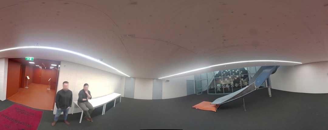
It is currently common to run indoor mapping during weekends to avoid running into people and request their consent for being captured. In addition to being uncomfortable, this situation is more expensive due to the weekend extra pay. Implementing anonymization by default will allow you to save costs and time and guarantee full-compliance.
Why Celantur is the answer
Celantur offers fully-automated image and video anonymization solutions to help companies and organizations comply with privacy laws. Our technology detects several objects to be anonymized such as faces, bodies, license plates, vehicles and facades, and automatically blurs them:
✅ We anonymize all kinds of RGB-imagery: planar, panorama images and videos
✅ Our cloud platform is capable of anonymizing around 200.000 panoramas and 24 hours of videos per day.
✅ Industry-grade anonymization quality: detection rate up to 99%
Trust & Compliance
Data protection is our core business. That's why, to operate as a data processor, we have robust measures in place to comply with the GDPR and other data protection laws:
- Images are processed in GDPR-certified data centres in the European Union
- External Data Protection Officer at service
- All data and storage devices are encrypted
- Annual Data Protection Audit
- Up-to-date Documentation: Technical and Organizational Measures ("TOMs"), Records of Processing Activities and Data Processing Agreement
Summary
- A digital twin is a computerized representation of a physical product, process or service.
- Digital Twins are created using various 3D capture systems mounted on backpacks, rollers and drones.
- Mobile Mapping made the data collection and processing of higher quality, faster and cheaper to enhance BIM models and Digital Twins.
- Privacy measures need to be in place since Mobile Mapping could capture faces and bodies.
Ask us Anything. We'll get back to you shortly